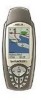
Magellan SporTrak Color User Manual - Page 7

Compass Screen, Large Data Screen, Position Screen, Road Screen, Satellite Status Screen, Waypoints - manual

Page 7 highlights

Compass Screen 30 Customizing the Data Fields 31 Large Data Screen 31 Customizing the Data Fields 32 Position Screen 32 Selecting the Position Screen 32 Resetting the Trip Odometer 32 Customizing the Data Fields 33 GPS Status Messages 34 Selecting Coordinate System, Map Datum and Elevation Mode 34 Projecting a Waypoint 35 Road Screen 36 Customizing the Data Fields 37 Satellite Status Screen 37 Waypoints / Database 38 Accessing Waypoints in the Database 38 Selecting Waypoints from the Nearest List 38 Selecting Waypoints from the Alphabetical List 38 Selecting Waypoints Nearest to the Cursor 39 Saving Present Position as a Waypoint 39 Creating New Waypoint Manually 39 Creating New Waypoint with Map Cursor 40 Deleting a User Waypoint 40 Editing a User Waypoint 40 Viewing a Map Object on the Map 41 Viewing a User Waypoint on the Map 41 Saving a Map Object as a User Waypoint 41 Searching for a Street Address 42 Routes 43 Creating a GOTO Route 43 Creating a Backtrack Route 43 Creating a Multileg Route 43 Activating/Deactivating a Route 45 Viewing a Route 45 Editing a Route 46 Magellan SporTrak GPS Receiver iii

  • 1
  • 2
  • 3
  • 4
  • 5
  • 6
  • 7
  • 8
  • 9
  • 10
  • 11
  • 12
  • 13
  • 14
  • 15
  • 16
  • 17
  • 18
  • 19
  • 20
  • 21
  • 22
  • 23
  • 24
  • 25
  • 26
  • 27
  • 28
  • 29
  • 30
  • 31
  • 32
  • 33
  • 34
  • 35
  • 36
  • 37
  • 38
  • 39
  • 40
  • 41
  • 42
  • 43
  • 44
  • 45
  • 46
  • 47
  • 48
  • 49
  • 50
  • 51
  • 52
  • 53
  • 54
  • 55
  • 56
  • 57
  • 58
  • 59
  • 60
  • 61
  • 62
  • 63
  • 64
  • 65
  • 66
  • 67
  • 68
  • 69
  • 70
  • 71
  • 72
  • 73
  • 74
  • 75
  • 76
  • 77
  • 78
  • 79
  • 80
  • 81
  • 82
  • 83
  • 84
  • 85
  • 86

Magellan SporTrak GPS Receiver
iii
Compass Screen
....................................................................................
30
Customizing the Data Fields
........................................................................
31
Large Data Screen
.................................................................................
31
Customizing the Data Fields
........................................................................
32
Position Screen
......................................................................................
32
Selecting the Position Screen
........................................................................
32
Resetting the Trip Odometer
........................................................................
32
Customizing the Data Fields
........................................................................
33
GPS Status Messages
....................................................................................
34
Selecting Coordinate System, Map Datum and Elevation Mode
..................
34
Projecting a Waypoint
..................................................................................
35
Road Screen
..........................................................................................
36
Customizing the Data Fields
........................................................................
37
Satellite Status Screen
............................................................................
37
Waypoints / Database
...........................................................................
38
Accessing Waypoints in the Database
...........................................................
38
Selecting Waypoints from the Nearest List
...................................................
38
Selecting Waypoints from the Alphabetical List
...........................................
38
Selecting Waypoints Nearest to the Cursor
...................................................
39
Saving Present Position as a Waypoint
..........................................................
39
Creating New Waypoint Manually
...............................................................
39
Creating New Waypoint with Map Cursor
..................................................
40
Deleting a User Waypoint
............................................................................
40
Editing a User Waypoint
..............................................................................
40
Viewing a Map Object on the Map
..............................................................
41
Viewing a User Waypoint on the Map
.........................................................
41
Saving a Map Object as a User Waypoint
.....................................................
41
Searching for a Street Address
......................................................................
42
Routes
...................................................................................................
43
Creating a GOTO Route
.............................................................................
43
Creating a Backtrack Route
..........................................................................
43
Creating a Multileg Route
............................................................................
43
Activating/Deactivating a Route
..................................................................
45
Viewing a Route
..........................................................................................
45
Editing a Route
............................................................................................
46